The farming software suite for confident decision‑making
A level of confidence in agronomic decisions that can only come from up-to-date data on vegetation, weather, and soil.
Why OGOR?
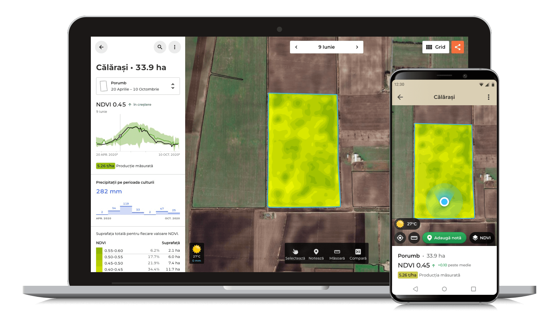
Active crop monitoring
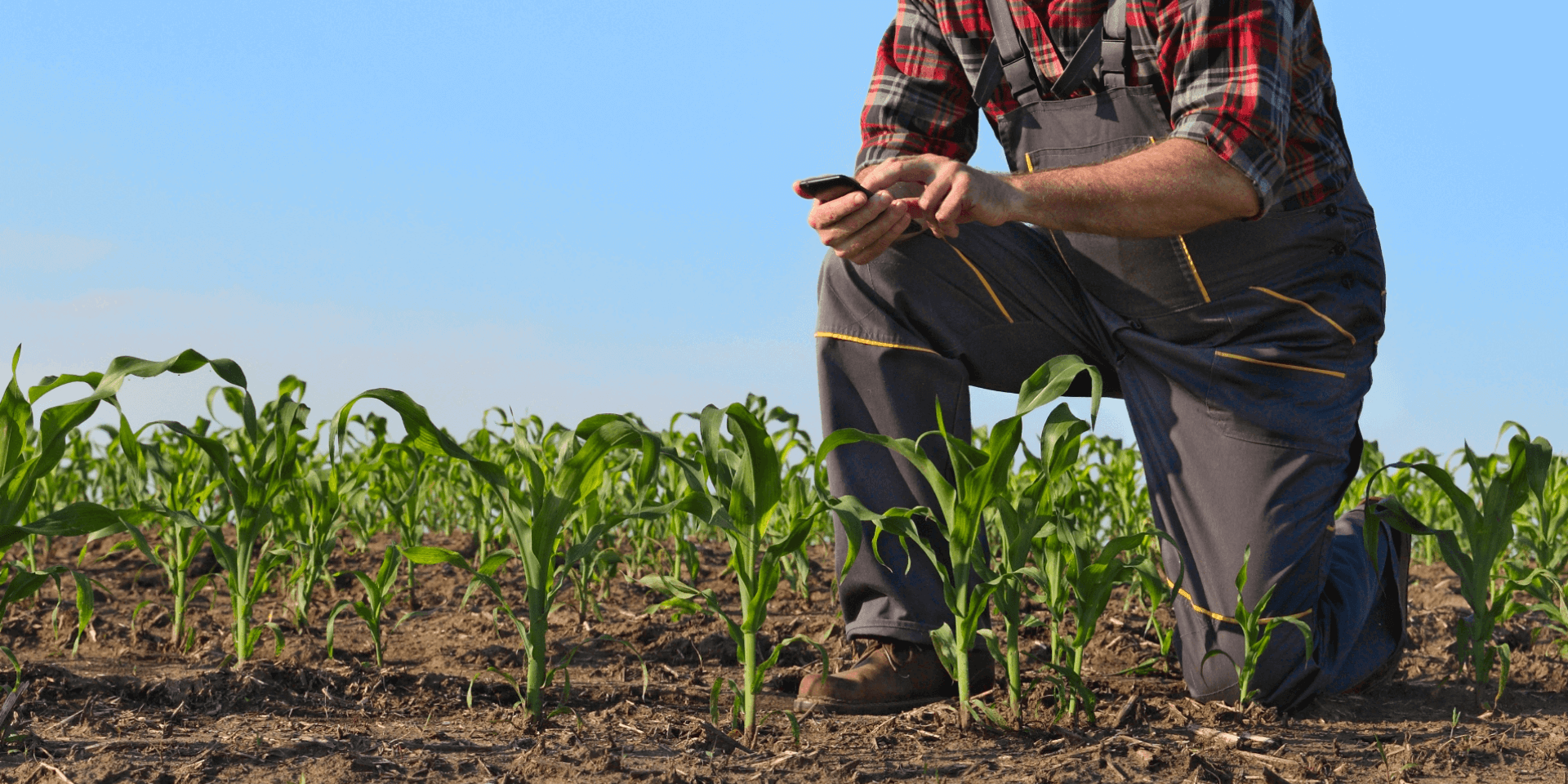
See vegetation before doing field inspections! With an aerial view of the farm, you can identify areas where crop growth is affected early.

In an increasingly challenging context in terms of climate, market, and agricultural policies, OGOR supports farmers with affordable solutions based on satellite imagery.
Early agronomic interventions
By looking at the farm from above, you can identify areas where crop growth is affected early, and dividing into management zones helps reduce costs through precise interventions.

Collaborative agronomic journal
Whether you have multiple people on the farm using OGOR or you consult external advisors, add photos and notes on the map to always know what happened on the plot and what work was done.

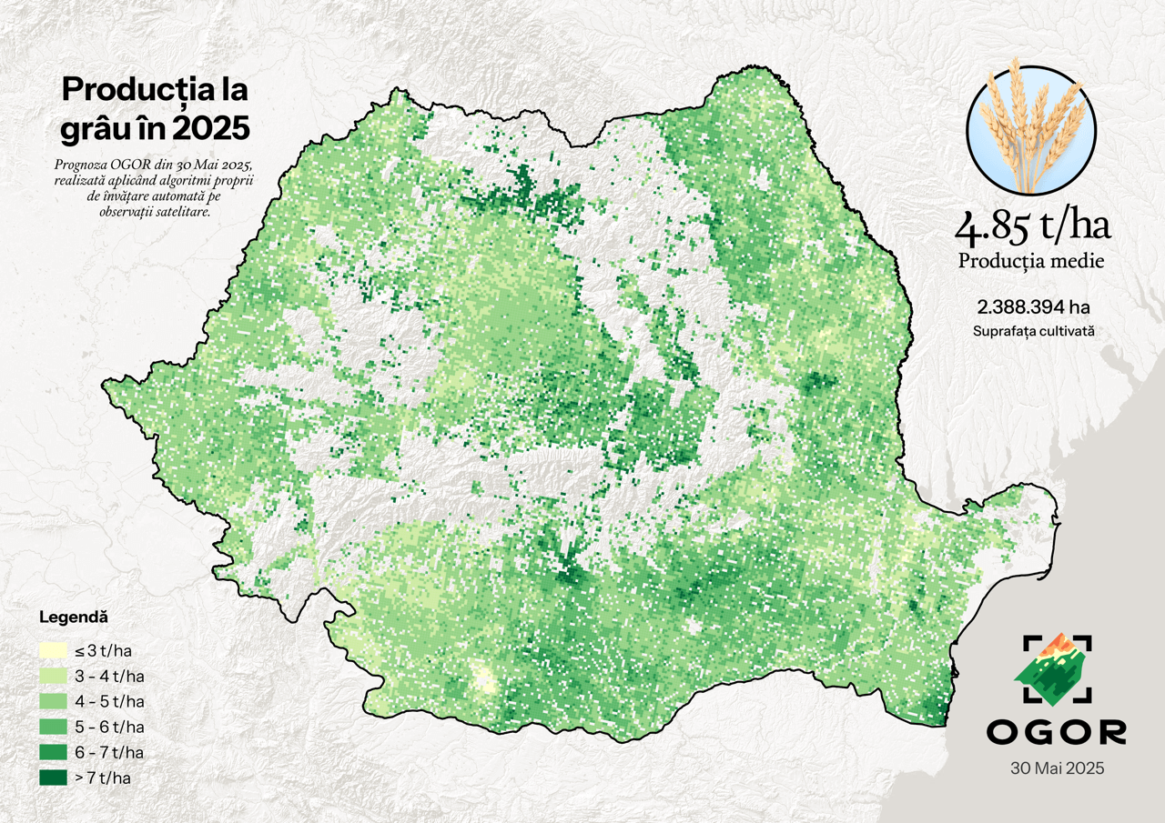
Yield forecast 2 months before harvest
By applying proprietary machine learning algorithms, OGOR provides the yield forecasts for maize, sunflower, wheat, barley, and rapeseed 2 months before harvest. The forecast is then updated every 2 weeks until harvest.
Plus:
Accumulated precipitation
A key indicator in estimating productivity, anticipating diseases and pests, etc. There is no precision agriculture without accumulated precipitation.

Weather forecast
For the next 7 days; every 3 hours for the current day! Weather data provided by Meteo Romania.

Soil water capacity
Soil water capacity at different depths for both spring and autumn crops.

Crop rotation
Instruments for managing and planning crop rotation from drawing parcels to setting crops.

Soil and texture map
Type of soil, texture, skeleton etc.

Variable Rate Application (VRA)
👍 Cut fertilizers costs. 💧 Save water. 🔻 Reduce chemical use. 🚜 Lower fuel and labor. 🌾 Increased yields.
Starting from $6/map →
Soil analyses
Soil and water analysis is the sure-fire way towards efficient fertilization and parcel ammendment, towards precision agriculture. In partnership with Alcedo.
What do OGOR customers say?
We constantly stay in touch with our customers to develop the best solutions for them. Here's what they had to say when we asked: How has OGOR helped you so far?
Oana Mihai-FloreaIt is a useful and easy-to-use application that helps you get an overview of the health status of crops. The fact that you can also add notes to parcels or manually measure portions of parcels are nice bonuses. It saves me time by directing me straight to where I see problems in the application. Additionally, the customer service should not be overlooked as it is impeccable.
Constanța, 650 ha
Petrică SurubaVery easy to use, accessible to everyone. Anyone can manage the farm and it has a very good quality-price ratio.
Suceava, 200 ha
Stelică LeopeaI monitor the vegetation stage of the crops, it helps me plan the season, make crop rotation much easier, and in addition, I can measure each plot in the application. Also, my employee knows which plot to go to efficiently.
Tulcea, 1600 ha
Silviu PeticăThe application has been helpful to me and, most importantly, to my employees for identifying parcels during day/night. For recording tasks, the NDVI map has helped me identify problem areas in crop development and streamline field visits.
Arad, 1300 ha
Costin PețancaOGOR is an easy-to-use application. As harvest time approached, I was better able to determine the optimal timing by seeing the green areas on the application. One improvement, if technically possible, would be to distinguish weeds from crop plants.
Giurgiu, 1100 ha
Turcan IoanVery good. It has helped us in many situations throughout the campaign. The mobile application is also very useful. It helps me monitor parcels through its measurement and season planning functions.
Bacău, 200 ha
Got questions? We are here to help you. We are available by phone or email from Monday to Friday between 9:00 AM and 5:00 PM.
It takes 3 minutes to upload your lands using the APIA account
★Works with existing equipment and requires no specialized training
★Technical and agronomic support throughout the agricultural season
With the support of:


Partners:
